Shahdad is 100 km to Kerman and 40 km to the legendary city of Kalutas. This area is known among geologists as one of the “Earth’s heat poles”. The same desert drought may draw tourists from Green Europe to Iran.
Near Shahdad, there are Nebaka (desert pots) sometimes up to 10 meters long, while the tallest desert Nebkas are 3 meters long.
The legendary city of Cloisters is 11,000 square kilometers wide and only 40 kilometers from Shahdad; it was created about 20,000 years ago by wind and water erosion. In the Shahdad Desert, there are 100 hectares of egg-boiling salt that are not similar anywhere in the world. Within a distance of 30,000 kilometers, in Del Lut, there is no life. Witness the claim that a healthy bovine body was killed in the winter of 2004 in the Lut Desert. After 15 years, the body of this cow – with dry sunlight – was found unchanged.
This heat and drought was thought to be the best source of income for the locals, but now they have nothing but harassment. The sharp increase in air temperature in July in the deprived part of Shahdad Kerman has forced many displaced families to migrate. The effects of rising temperatures have had an adverse effect on agriculture.
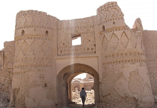
Khabis, or the ancient name of Shahdad, is located on the western edge of the eastern slopes of the Sirch Mountains. It lies at the foot of the highest mountains in the region, such as Sirch and Jaftan, with its highest peak reaching 3,990 meters.
The peaks of this mountain range are snow-covered until the end of May; hence, a lot of water flows into the plain.
On the western margin of the Lut Plain, except in the Bam area, there is no such permanent water supply. For thousands of years, it seems that Khabis has been the largest area for population concentration.
Shahdad is 430 meters above sea level. It is about 30 km east of Lut Plain, overlooking a plain called Takab, which forms the main part of Khabis.
Shahdad’s permanent water is supplied from the Darakhtegan River. The river originates from the Heinaman heights and traverses through the valleys; at the entrance of the “Four Farsakh” Gorge, it diverts to the north, then flows through the Ibrahim Abad River to Lut. The water of this river is abundant in winter and in summer. At the Four Farsakh Gorge, a branch is separated from the Darakhtegan River and runs east to Shahdad.
The present martyrdom is triangular in shape with its head facing the valley of the “Jaharan” and its base to the east in the Takab Basin, leading to parallel ridges of the Lut margin. The fields of Shahdad are all covered with citrus or date gardens.
At present, it is the only water that has bound the people of the city to this region.


www.xmc.plFebruary 21, 2021
This web page is mostly a walk-by for all of the data you wanted about this and didn’t know who to ask. Glimpse right here, and you’ll undoubtedly uncover it…
http://www.xmc.pl
WWW.XMC.PLMarch 4, 2021
The way you write make it very simple to read. And the template you use, wow. It truly is a really good combination. And I am wondering whats the name of the design you use?
http://www.xmc.pl