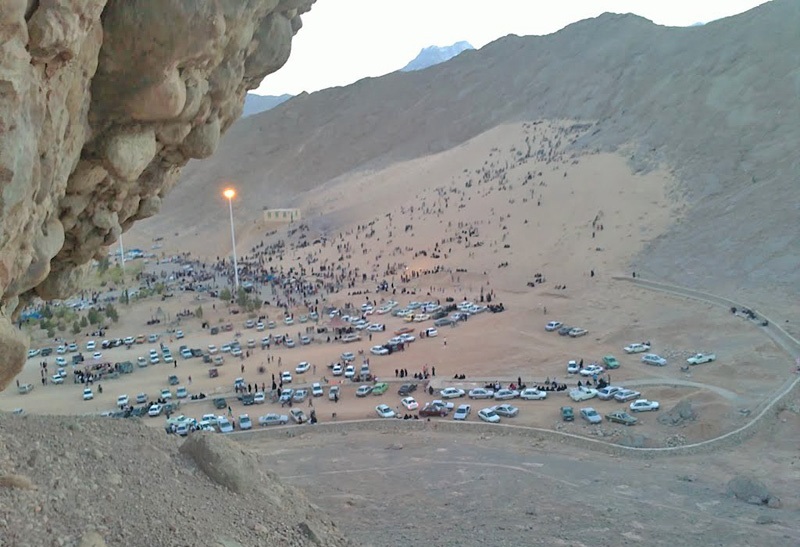
Mount Rig is located at N3134 E5424 geographical location in Yazd province. Ardakan Desert is about 1,300 km2 in a desert hole that runs from the north to the Black Mountains and the Clout Hills, from the West to the Nain Mountains, from the East to the Kharang Mountains and from the South to the Strand. Mountain lions and lions are restricted. The region has a warm and dry climate with relatively cold winters. The average annual rainfall in Ardakan is 52 mm, according to a ten-year statistic. Rig Mount is located six kilometers southwest of the village of Sorolia in Ardakan. At the heart of the mountains is a sandy mountain that has created a pristine area.
Read More ...
Genesis
Ardakan Desert is a closed desert that has no connection with its adjacent deserts such as the Golden Desert and the Lut Desert, under current weather and hydrological conditions, although it is likely that during the fourth period under water conditions nearest adjacent pits. Alluvial cones and flood sediments are intermediate phenomena between the surrounding mountains and the desert margins. Their coarse-grained material masses have been more favorable conditions in the past for extensive and lifelong floods The exact timing or periods of these more humid conditions are not yet clear to us. From the topographic and natural features of the Ardakan-Yazd Desert Basin, much resemblance to the Great Basin and the mountainous area of the western United States. The United States has. In both areas, sand dunes and other wind congestion phenomena are relatively small compared to other geomorphological phenomena.
In central Iran, despite the high percentage of dry land, the emergence of sand dunes is limited to certain areas adjacent to or near the sources of sand production. Compared to the total extent of each basin, relatively low-lying sandstones at some desert levels And marshes that are more or less humid (Zarrin Desert, Ardestan Desert and Gavkhuni Swamp), or have emerged in close proximity to deserts that are a good source of sand (Desert Plain and Lut Plain). ). The movement of wind sands from or to the surface of these deserts may be exacerbated by the high percentage of soil salt, which on the one hand causes the lack of vegetation and on the other hand causes the clay to disintegrate. Which helps to release the sand particles. In the Ardakan-Yazd Basin, a relatively small patch of sandstone hills, such as about 300 km 2 (total area of 28,000 km 2), was created 60 km southeast of Ardakan Desert. The collection indicates that sand is most likely brought from the southern desert area, along with western winds.
In parts of the Ardakan-Yazd Basin, especially in a specific area to the southeast of Ardakan Desert, sand dunes are formed on the slopes of the local mountains and the surface of these hills is partially covered by bushes. One of these hills, which is closest to Ardakan-Zarrin Road, located on the southern slope of Anbar Gore Mountain, on the southeastern margin of Ardakan Desert, is described as a windmill 11. He argues that these sands were brought to the mountain by the north winds of the desert, then crossing a large embankment in the form of seven wind gorges 12 at the top of the mountain that formed the wind tunnel, on the opposite slope (south). They have collapsed and become compressed with a sudden drop in wind speed. As a result, he has calculated this sand density as descending or relative wind sands. However, our study shows that:
First of all, this hill has no elongation to the south, which is a sign of its non-formation in relation to the descending sand through the large apex of the mountain; secondly, on the north side of the mountain there is no trace of the hill. There is no upward or gentle relative slope through which the sand reaches the summit and is transported to the south face; thirdly, the sand particles thicken towards the foot of the mountain, indicating that the sand from below Are moved upward and driven by the gravitational force (and here the gravest) at the bottom, the midrange to the middle, and the finer to the top of the slope. It is a type of uppermost that is mostly formed by southern winds. Other similar sand densities on the southern slope of the Pyrenees Mountains can be justified by the southern winds. These winds carry sand into a small basin. Surrounded by the Harriet Mountains, the Old Lady, the White Pond, and other local mountains.
Position and Specifications
The largest single wind phenomenon in the Ardakan region and probably in the whole Ardakan-Yazd Basin is a huge sand dune that originated in the Saddle Valley between two calcareous mountains 20 km northeast of Ardakan. It is Cretaceous and one of them is more than 1800 meters above sea level. The valley floor has a slope between 5 and 10 meters high that extends up to about 1,300 meters (109 meters) above the surface of the adjoining plain. Occasional flows on the north and south sides of the saddle-shaped drainage deep waterways. At least 5 meters in length, the same waterways have caused vertical shear to a depth of about 25 meters in wind-clastic sediments so that the material and structure of this phenomenon are well exposed. Waves with wave effects Wind is visible locally on the Kohrig, but the Kohrig surface is covered in low-lying areas with shrub and scrub bushes.
At the highest ridge of this cluster, the surface effects of the movement of sand are seen, which is negligible compared to the total sand thickness. This is a wind-clastic phenomenon known locally in Ardakan and Yazd. Elsewhere in the world there are similar specimens called ascending sand, although they have described this phenomenon as ascending and descending hills, but new observations suggest that this is not the case. The Kohrigi sediments, of course, contain a large amount of sandy sand that is deposited in the slopes of the mountains. In addition, they also contain multiple layers. The debris deposits, alluvial and other deposits on the slopes of the bulk material, which frequently between layers of sand were deposited.
Another common feature of the Ridge Mountains is their relatively mild slope, while ascending and descending dunes are often compressed by a maximum or gradient slope, which also affects the slope of the barrier it encounters. it depends. In the Mojave Desert, 18 California, where most of the cohort studies have been conducted to date, it has been concluded that most cohorts are formed in situations where there are constant obstacles in the path of wind sands such as local roughness. The Ardakan cluster contains both upward and downward dune features that indicate sand densities during the transmission by wind. The structure and shape of the sand layer density and slope show that southeast winds They have been responsible for the transport of sandy sediments. The direction and shape of the deployment of other mountain ranges in the area (Old Mountain), including the one reported by Krinsley, also supports this view.
Sedimentological features
The pebbly and sandy layers originate from the Cretaceous limestones, and their rock fragments are angular, indicating that they have been transported a short distance. The thickness of the large rocks varies from 7 to 20 cm but at Some coarse-grained lenticular lenses (for example, at C1, 1.8 m high) are 40 cm in diameter. Most of the lamellar layers except for C1 and C2 have sandy elements. Are wind. C1 and C2 consist exclusively of debris material. In S1, at a height of 7.5 m from the cut leg, red sand is oxidized to a thickness of 30 cm in prismatic structure (cracking). Probably due to soil formation and interruption of aeolian sedimentation. The highest section consists of a 30 cm mixture of crushed stone and sandstone that is hardened to about 40 cm from brown to reddish sand sands. The gypsum crystals are located 24. This sandstone unit has a columnar and prismatic structure that indicates a poor soil type.
Old age
Ardakan’s thick sediments of Ardakan are densely packed under conditions quite different from those of the present. The movement of wind sands on the surface of Kohrig is currently limited and local. Two hypotheses can be put forward for the formation of these sediments: (a) condensation of the sandstones in different periods with prolonged depositional intervals indicating degradation and formation of soil layers; Density of aeolian-detrital layers together over a period and limited formation of degraded coarse-grained soils and sediments related to the same period but under specific conditions and relatively short intervals. To test these two hypotheses, seven samples for age Optical detection was obtained from different depths of vertical incision.
Photographic age-detection
Absolute Age Determination by Optical Reflection (OSL) determines the lifetime of sand particles since they were last exposed to sunlight. For sand sands and buried debris such a time In fact, their life span will be from the time of deposition.
Optical sensing was first experienced by Huntley 28 and his colleagues (1985) using quartz in archaeological studies. This method is in many cases superior to thermal reflection (-TL) sensing. This is why optical sunscreening has been used for dry sand in wind areas.
This method can be summarized in that the sediments contain small or large amounts of the elements uranium, thorium and potassium that emit radioactivity over time. These reflections are gradually and continuously reflected by the sand grains in the environment. (Especially quartz, feldspar and feldspar crystals) are absorbed and stored. This absorption and storage of radioactive reflection begins when the deposition is protected from sunlight, or in other words, buried and covered. Transfer shielded light to the laboratory in a fully covered area It is possible to use green or thermal light waves Edon Red traps the radioactive traps of the crystals and releases the stored radioactivity. The important point here is the complete and accurate release of the radioactive reflection as well as the precise calculation of its amount. Sampling is possible in specific ways and with high precision.
Field sampling method
From 25 m thick Koohrig, layers between 10 and 20 m depth were not available for sampling due to available facilities. As a result, six samples were taken from the bottom 10 m of the cut and one from the top of the sedimentary cut. The lower samples were mostly because they included the most important sedimentary layers (C1 and C2) and an ancient soil index layer (S1) 32. Optical age-specific sampling should be done so that the sample is never exposed to light. To do this, the surface of the wall is first cleaned with a spatula and then molds of compressed sand at least 30 * 30 * 30 of the wall The molds were immediately wrapped in thick black plastic and transferred to the temporary center of the group in Ardakan, where they were transferred to a dark room with a weight of approximately 300–250 g in the dark chamber. After closing in the tubes, they were all wrapped up in the same dark room in laminated black plastic.
Age determination procedures were performed at the Dry Areas Research Laboratory in Sheffield (UK). Preparation of samples was performed in a standard darkroom, including chemical washing of sands and removal of carbonates and organic matter from quartz. Sand particles were equally separated by sifting at 180 micron grains. Quartz particle removal was carried out by floating the material in sodium polystyrene (2.7 specific gravity). From hydrophilic acid. It was used for 60 minutes to dissolve feldspars and to clean quartz grains (Bitman & Coat 199633). Preparations of each sample on aluminum discs 1 It was loaded 0 mm and all optical measurements were performed using a Huawei 34 U340 filter and a RISO 35 computerized photometer. The quartz separation and purification levels were tested by reflective infrared waves. The results showed a positive and purified quartz. Was.
In order to measure the long-lived 36 light emission, a computerized index curve based on Controlled Addition (Mujahedin 198737) was used to measure long-range optical radiation (24-disk) and a single-disk $ 38 (1995) method. In both methods, Optical reflection was obtained by the halogen green lamp. Also, by heating the samples at 220 ° C for 300 seconds, any unstable waves were eliminated. The optical reflectance of one sample quartz (Shfd 95010) to the extent that The curve could not be presented as desirable, and only waves were transmitted at the bottom of the infrared spectrum, so the age of the sample was not obtained by this method. Extra samples were tested annually on the site (Koehrig Ardakan) for the amount of uranium, thorium and potassium (radioactive elements). The amount of probable annual atmospheric radiation depending on the depth of each sample, height, latitude and longitude was obtained. See Prescott and Hutton 40 (1994). In this case, the grain size and density of the samples as well as the long-term moisture content of the samples were taken into account. High error range (high statistical freedom percentage) was calculated to include any possible fluctuations.
Findings of the experiments
The ages obtained are based on the chronological year of the present (1997). All ages are between 25,000 and 18,000 years ago with a standard deviation of between 1000 and 3000 years. The results are in the wrong statistical range. As a result, the Kohrig Ardakan phenomenon has been condensed over a continuous quaternary period of about 5,000 years over the last glacial period, with the S1 layer present as a weak layer. The soil is interpreted to represent a sedimentary and soil-lagging interval, but given the number of ages, the timing and duration of this period is unknown.
Discussion and commentary
Ardakan’s Kohrig study shows that conditions during the last glacial maximum period were more suitable for transporting and compacting sand in this area than now. Despite the current dry weather, under the conditions at the Ardakan site, the density of sand deposits was higher. Either the wind is not normal. Both the lack of sand supply and the change in the prevailing winds in the present conditions may be reasons for this serious inactivity of Kohrig. Although the origin of the Kohrig sand has not been determined, it appears at present. There is no sand to feed it. The active sand dunes at this time are mostly adjacent to the main axis of the Ardakan-Yazd plain which is a waterway. The main passes through it and the desert margins are limited.
The dominant winds of the area today are blowing from the west. The maximum wind erosion and transport in this area is due to the north and northwest winds (Hafsani & Ahmadi, 1993). However, seasonal and local sand transport by winds The southeast is also probable (Motamed, 1992; Jafasi and Ahmadi, 1993) and these winds may be important under specific conditions for sand removal from abandoned floodwaters along the Ardakan-Yazd plain. NW are more important in sand transport, but the continued dense concentration of Ardakan cohorts is likely to be overcome by severe southeastern winds. A dry period is possible. The ages for the sand samples obtained in this study indicate that the clastic and sedimentary deposits are not related to different climatic conditions but both during a water course. Uniform climates have been deposited. On the contrary, the ages obtained for similar formations in the Mojave Desert indicate that the thallus and archaic layers of the soil are different from sandy layers in separate periods under different conditions. Have been formed based on pollen and chemical research on the Zarivar Lake deposits in Kurdistan of Iran, during the most recent glacial period. Much colder and drier in western Iran. Kuhrig’s sedimentary work in Ardakan-Yazd shows a similar and even drier, colder, and certainly more stormy situation in central Iran. Conditions that permit continuous and continuous congestion It provided wind and sedimentary sediments over a period of 5000 years, near the peak of the last glacial period. The temperature drop caused more freezing and increased physical weathering resulting in the provision of deposits. Today, a limited and scattered amount of debris is found at the Kohrig surface, probably from the remnants of earlier sediments that have survived for some 17,000 years before and after the suspension of the major Kohrig sedimentary period.
Today, cold and dry weather in Iran is dominated by the high-pressure Siberian system, the dominant Asian winter system, in the region. The southeastern cold and dry winds that have been reported in the region during the cold season (Mehrshahi, 1990; Hafasi and Ahmadi, 1993) may be related to this system. Ardakan’s Kohrig direction is opposite to the current main winds, west-northwest, in Ardakan-Yazd plain. Therefore, there is evidence of a connection between the Siberian high-pressure system and the southeastern winds in this area. It seems that during the maximum glacial advance in central Iran the Siberian system dominates and with it severe winds from the southeast causing large amounts of sand to be transported to the basin enclosed between the Piersen, Harisht and other scattered mountains adjacent to Ardakan Desert. These mountains actually prevented the sand from moving. The lack of moisture and dryness on the one hand made it scarce. The soil has become cloudy and, on the other hand, the vegetation has been reduced due to the prolonged cold period. These factors have increased the possibility of wind erosion and sand removal from accidental canals and conifers. Coarse-grained and highly angular debris layers of the Kuhrig Ardakan siliciclastic layers show severe cold and frost, which may justify the existence of a high-pressure Siberian system in the area. Clusters at Kohrig’s Site New conditions have been created for the flow of water in the area that has caused a deep cut at the interface between the mountain wall and Kohrig. The deep trench mine cuts off the main part of the Koohrig and the adjacent wall of the two mountains, thereby eliminating the possibility of possible debris falling over the Koohrig surface. However, even the bottom of the existing canal has been traced Deposition does not indicate debris or other materials caused by mass movement, indicating that the debris density is minimal at present.
Result
Light-age deposition about 25 m from the debris and debris deposits of the Kohrig Ardakan have been left around the maximum of the last glacial period. This is the case for at least a 5,000-year period when the Siberian Highlands were deployed.


