Hemmatabad (also known as Ahangaran and Petregan Rig) in the geographical range of 60 degrees to 60 degrees 34 minutes east and 33 degrees north 35 minutes to 33 degrees 17 minutes north in the southern Khorasan province near the Afghan-Dagh Petgan border. contract. Naming Rigsar is based on the village of Hemmat Abad in the south. This village is located 2 kilometers from the city of Qainat and 2 kilometers from the Zirokoh district in South Khorasan province.
This ridge is part of the Qaenat Shahrasht plain. The area is bounded on the north by the Shahrokht Mountains and on the east by the Sakhar and Karizak Mountains in Afghanistan, on the south by the Hezar Sangan Mountains and on the west by the heights of Gazik, Gazht, Blacksmiths and the Three Breasts. The basin is 4400 square kilometers or 440,000 hectares, of which 3150 square kilometers or 315,000 hectares are elevations. The highest elevation is the Three Breast Peak Plain and the lowest elevation is 590 m. The climate of this plain is warm, dry and moderate, and its rainfall is about 150 mm and at altitudes up to 400 mm. The average depth of water in 1997 is 31 meters and the average annual water level in this plain is estimated to be 8 meters.
Read More ...
It is bounded on the north by the towns of Haji Abad and the river Haji Abad on the south by the village of Hemmat Abad and Dasht-e Gaz, on the east by Petgan Dagh and on the west by the Mirza Arab and Tajnood Mountains. The height of the plain from the surface of the open waters in the western regions decreases by about 1000 m as it moves eastward and up to 620 m. The direction of the hills in the eastern regions of Rigsar to the northeast and in the central and western regions lacks a clear direction. It passes through the middle of the Rigzar River, which runs through the Black Mountains with a stream of karstic springs originating in the tributaries. Its water quality is excellent. The river crosses the river 13 km after crossing the village of Tajnood Vatti and its surplus flows into the Petrgan River. The river has a west-east direction. Petroglyphs can be reached through the bed of the river if the car is dry if it is dry. (For more information see Doug Petgan’s article.) The presence of nomadic roundabout desert tribes in this area is one of the tourist attractions.
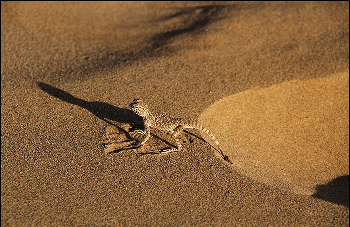
This region is one of the richest and most active desert ecosystems in terms of vegetation and animal diversity in Iran. The area’s wildlife cover includes desert birds such as Hobre, Bohr, Hawk, Cuckoo, Fly, etc. Snake and Scorpio, Sand and Fox, Wolf, Caracal, Jabir, Agama and Jacko and more.
Vegetation of the area due to high groundwater level and saline-friendly vegetation in the eastern areas and sandy and steppe plants in the western areas including, scallops, artemisia, butterfly, gaz, tail cow, squirrel, scabber, goat beard. , And so on. The region also has a digital endemic diodal plant sample that is protected by the UN in the region’s biosphere reserve. The presence of nebkas and oak trees, sometimes grown up to 5 meters high, is another unique feature of the area that requires the attention of more concerned conservation organizations.
Access to the sandpit is possible via the asphalted road of Haji Abad to Hemmatabad. It can also be accessed from the Birjand road to Yazdan village on the Afghan border and the use of branch roads


