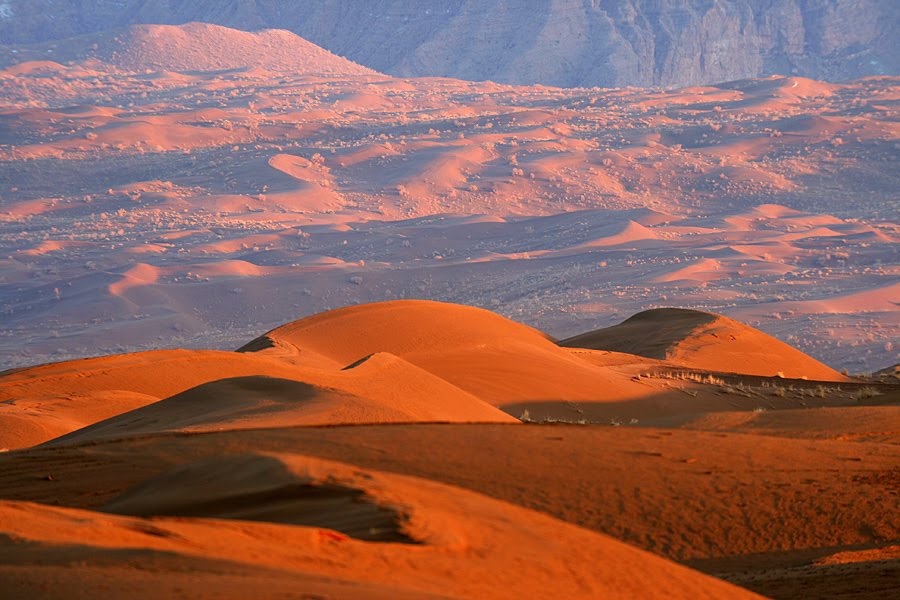
Yigle is located in the geographical location of N340022 E545059 in Isfahan province and the southern edge of the Egyptian village. If you travel to the Egyptian village, you will find elevated sand dunes that are distinct from other sandy areas in the south of Khor Road to Egypt and where the southern highlands of Egypt are visible. The hills are intertwined and visible from a distance. This area is known as the Riggle Head. There are several sandbags in the Ridge Head, and the shape of the hills is different from the other sand dunes in the area. In 1355, the huge flood that devastated the Egyptian village originated right in the area and in the southern mountains. The effects of this terrible flood have created several gods in the region, with dry valley beds such as these still visible. There are 3 goddesses in this area, the most famous of which is known as Goddard Crow and is sometimes visited by tourists.
The highest sand dune in the Rig Kale is 1137 meters above sea level, which according to the height of 910 meters in the western plain, the height of the highest dune will be about 227 meters, which lies in the circle of Iranian high sand dunes. This area is very rich in vegetation. Sandy plants such as hawthorn, scabnil, nettle, cow tail, squash, nettle and so on can be seen in mass plant communities. The area has wildlife including sand foxes, sand cats, snake bears, snake camels, parsley snakes, scorpions, steppe agama and black tails, pomswaki and more. It is worth noting that the area has been grazed by the Forests and Rangelands Organization for five years, and therefore any grazing or plant removal would be prosecuted for any reason. You can reach Rig Kel by using assisted cars from the 5 km of Amir Abadbe village to the south.


